Monday 5 November 2018

New Mexico Trip #38, Part 4: The Long Drive Home

We left Albuquerque on Tuesday morning, arriving home mid-afternoon Friday.  Again it was an Interstate drive, with the heavy truck volume getting worse the further east we travelled.  I'm not certain how much longer passenger cars and transport trucks can continue to share the road, but it can't be too much longer.  On Tuesday we drove to Oklahoma City, driving 536 miles.  We stopped in Amarillo for lunch, and in Shamrock, TX for coffee.  Oklahoma City is a mess of construction, with traffic jams to give one nightmares for a long time.  With Navigator Deb using live Google maps, we were able to sneak into our hotel using alternate routes without encountering any backups.  We had to resort to a toll road at one point, which cost us 45 cents.  It was worth the unplanned expense.

On Wednesday our drive was considerably shorter, at 401 miles.  We paid a visit to the Gilcrease Museum of Western Art in Tulsa.  It had been many years since our last visit.  We next stopped in Joplin, MO for a visit to a nearby waterfalls, and then went into the city for afternoon coffee.  Joplin Ave. Coffee Company was a pretty cool place, with fantastic coffee.  The city had been devastated in 2011 by an F5 tornado, with winds exceeding 200 mph.  There were 158 deaths, over 1100 injuries, and it turned out to be the costliest tornado in US history.  Driving in along the main street, there is suddenly brand new housing stretching for miles, and no mature trees at all.  Very eerie.  The main downtown area seemed okay, which is where the cafe was located.  The Wiki article makes for chilling reading.  That night we stayed in Rolla, MO, enjoying a break at Public House Brewing Co.

 Entering the Gilcrease Museum, Tulsa.

 Painting by Thomas Moran.

 Gilcrease gallery.

 Downstairs at the Gilcrease is the collection of prehistoric art.  In addition to the displays, thousands of objects are accessible in drawers, which include jewellery, sculptures, weapons, bead work, clothing, and other artifacts.

 Painting of a ceremony at Taos, NM.  Gilcrease Museum, Tulsa

 View of downtown Tulsa, from the Gilcrease Museum.

 Waterfall near Joplin, MO.

 Waterfall near Joplin, MO

Public House Brewery, Rolla, MO.  the food was also good!

On Thursday we drove 394 miles, staying in Anderson, IN, just north of Indianapolis.  We cruised into town just before rush hour, stopping at the north end Whole Foods store for dinner.  Between rush hour traffic and construction, we barely managed to get to our hotel with some sanity remaining.  Just as we pulled off at our exit for the hotel, traffic came to an absolute standstill.  We had escaped by the skin of our teeth.

Friday found us only 260 miles form home.  My third bookstore awaited, and I came out of Hyde Brothers Books well stocked, especially with books by Michael Moorcock.  I made it home with nearly 70 used books.  The shipping alone on those books, if ordered on-line, would have amounted to more than I actually spent on all the books.  We stopped in Waterville, Ohio for a vegan lunch at a downtown Mexican restaurant, then headed for home.  We were home by 3:30 pm!  Trip #38 was in the bag, and it was a great one!

Thanks for stopping by.

Mapman Mike

Saturday 3 November 2018

New Mexico Trip #38, Part 3: Three Hikes Near Grants

Our 2nd hike of the trip (we would accomplish four of them) was to walk up the steep side of an extinct volcano.  The Cerro Americano hike was done on my 65th birthday.  It was only 3 miles, with 500' of elevation gain, but it was a treacherous climb, much steeper than any photo would indicate.  It was very loose sand and rock, with a few scattered tufts of grass to help with footing.

 Our route up and down Cerro Americano, our 2nd hike of the trip.  The summit is 8075', making it the lowest hike of the four we did.  The hike begins at 3 o'clock in the above Google Earth image, and proceeds counterclockwise. It was a strenuous hike despite its low mileage and elevation gain.

   
     Cerro American rises 500' above the plain.  It doesn't look so bad from here, but it was!  Think of a 50 or 60 storey building....

Volcanic rock near the summit of Cerro Americano.  And Deb. 

We took our sweet time ascending and descending, as a fall, once begun, would be unstoppable until the bottom.  Our GPS trail is shown in red in the map, above.  We parked Beorn and hiked northwest, passing an encampment of hunters, who were not very active this time of day.  Once at the top of the mountain we had excellent 360 degree views of dozens of other cones and volcanic outpourings, including Mt. Taylor, the largest mountain in the area and our hiking goal for Monday (today was Saturday).  The summit today was an open bowl, washed away on the north side, giving it a horseshoe shape (see our trail at the top, where we followed the rim).  We could have climbed down into the crater, but once aloft we preferred to stay up top for awhile.  It was a challenge to find shade and a log on which to sit, but we managed.  After lunch we headed back down, going almost as slowly as we did climbing.  The steepness of the slope was extreme.  Slow speed danger, one might say.

 Cerro American summit, from the highest point and looking across the bowl, or crater, to the far side.  We followed the ring of the summit all the way around, eventually eating our lunch on the far side.

Summit view looking northeast.  All mountains in view are extinct volcanoes, including Mt. Taylor in the far background, where clouds are gathering.

 Now looking southwest from Cerro Americano, with more extinct volcanoes in view. 

Once back at the truck, we headed back along the very wet and rutted dirt road.  We made a detour to visit some lava tube caves near the edge of El Malpais Wilderness, a vast area of volcanic doom that still shows clear evidence of the destructive power of lava.  The caves can be found by following well camouflaged cairns.  There is no trail, just sharp rock.  We visited one lava tube, all of which were once conduits for underground lava flows.  As time went on the roof caved in, making tunnels with occasional openings, allowing access.  Again, we did not descend into the tubes today, but merely stood above them and looked.  We hope to return here someday and get right inside of them.

Deb stands near the edge of one of the holes allowing views into the lava tubes.

 This arch looks ready to collapse, but for now one can cross it to the other side.  Lava once flowed through this channel.

 Somehow a forest has sprung up over top of the lava.  It has taken about 1500 years to get this far with natural recovery. 

______________________________________________________________________

Our third hike was to the highest summit of the Zuni Mountains.  Mt. Sedgwick is in the north Zunis, and entailed a long drive around the mountains, and then south into them from I 40.  Once leaving the area of the freeway, we were on good gravel and dirt roads.

Before we were done driving today, Beorn would be a lot muddier.

Mt. Sedgwick looms in the distance, as the highest peak in the Zuni Mountains.  Our road crossed the high plains, then climbed into the forest.

Our hike begins at this old forest cabin, just before reaching Ojo Redondo campground, following an old forest road.  

Today's hike was 5.4 miles, with 740' of altitude, topping out at 9,266'.  This was over 1100' higher than yesterday, but 1400' lower than our hike in the Sandias.  Still, it was pretty high, and our lungs were feeling it.  The hike was along a dirt road, so it was much easier than yesterday's wilderness scramble.  In April the area was hit by a massive forest fire, one of two bad ones to hit NM in 2018.

Mt Sedgwick is in the upper right, and the forest cabin is in the lower left.  This was quite a lovely hike, though marred by a lot of cindered forest.  Had we hiked a year ago we would have seen things at their very best.

 Approaching Mt. Sedgwick, and experiencing the extensive burned area.

Summit view northwest, towards red cliffs and Gallup, NM.  We shared the summit with a small herd of skittish cattle.

 Looking towards Mt. Taylor (tomorrow's hike) from Mt. Sedgwick.  The distant peak is 2,000' higher than our present location.  Did I mention yet how beautiful the weather was during all of our hikes?  It was amazing!  

_________________________________________________________________ 

Our 4th and final hike of the journey was to the summit of Mt. Taylor.  It involved a considerable drive from downtown Grants.  In the past, the final road to the summit has been awful, filled with large stones, potholes, and bare rock.  However, this year the road was nearly perfect, and that eliminated a long walk for us.  The summit of Mt. Taylor can be easily reached if one is able to drive all the way up to the high saddle between Mt. Taylor and its near neighbour, La Mosca.  These two summits are the highest peaks around until one gets into the Rockies near Santa Fe.  We hiked up to Mt. Taylor and back, and then drove up to La Mosca, where there are electronic towers and a forest fire lookout.  We met two other hikers, who arrived at the summit from a different approach, after we had been up there for awhile.  We were able to take each others group photo!

It is a very scenic mountain drive from downtown Grants to the high country beneath Mt. Taylor.

 We parked at a high saddle at over 10,000', with views towards the La Mosca fire tower and electronic towers.  That worthy summit is a few hundred feet lower than Mt. Taylor, but the views are just as good.

 The double line indicates our ascent and descent of Mt. Taylor on foot, including a side excursion to a rocky outcrop.  The single line indicates our drive up to La Mosca.

View south from Mt. Taylor.

 Summit view, Mt. Taylor.

 Summit view, showing the opening where lava once flowed freely into the plains.

 L to R:  Me, Pogo, and Deb.  This was our trip highpoint, and it was plenty high enough!  We remained aloft for a long visit, including a picnic lunch.  We were joined by two young men who had come up via a longer and more strenuous trail.  They had assumed that the road was too bad to drive up, and were surprised to hear it was in good condition.

 Our return trail, showing the road up to La Mosca towers.  When our hike was completed, we drove up that mountain for more fun and adventure.

 Looking up towards La Mosca fire lookout from the electronic towers after our drive up the mountain.  Beorn needs a bath!

2nd highest summit in the area.

 View down to Beorn, at 10,950', and the electronic site.  Note the football field left of the towers, a remarkable natural phenomenon.

 View north from La Mosca.

It was September 24th, but autumn was well established in the high country.

Once back down in civilization we headed for coffee, than a car wash, and then on to this amazing brewpub, sharing digs with Lavaland RV Park!  They had excellent home brew, and this place is on my permanent happy list!

An amazing sunset over Mt. Taylor, as seen from our hotel balcony in Albuquerque that night.  It was also a full moon, and our final night in NM.  Tomorrow the long drive home began.  As Deb was driving back with me, we added a few fun stops to break up the drive.  The weather had been perfect, we had completed our four hikes, and it had turned out to be yet another totally amazing visit to this wild landscape. 

Mapman Mike


Monday 29 October 2018

New Mexico Trip #38, Part 2: Albuquerque and Santa Fe

We spent three nights in Albuquerque upon arrival, and a fourth night on our way back home.  Wednesday was a hiking day, at the very top of the Sandia Mtns., which overlook the city and most of central New Mexico.  I had a minimum driving day, which was fantastic after 4 days of mostly driving.  We drove to the Sandia Tram and caught the first flight of the day to Sandia Peak.  I have been up five or six times, and each time is an adventure.   It is the world's 2nd longest passenger tram, and takes the passengers from high desert at around 6,000' of altitude to over 10,000' well up into the spruce and conifer zone.  The ride takes about 13 minutes and provides some of the most dramatic mountain views one could ever imagine.  Much of the western flank of the Sandia Mtns. is so wild that it is virtually impossible to explore.  However, some rugged trails do wind their way up.  But it is the forested eastern slopes that have most of the hiking trails.

 On the Sandia Tramway, heading up to Sandia Peak.  Our goal today was to reach an old cabin (tiny white dot on top of the highest peak), then continue along the crest trail to the highest point.

 Telephoto shot showing the cabin a tiny bit better than the previous photo.  We would hike to the cabin from the top of the tram, then continue on to the crest.

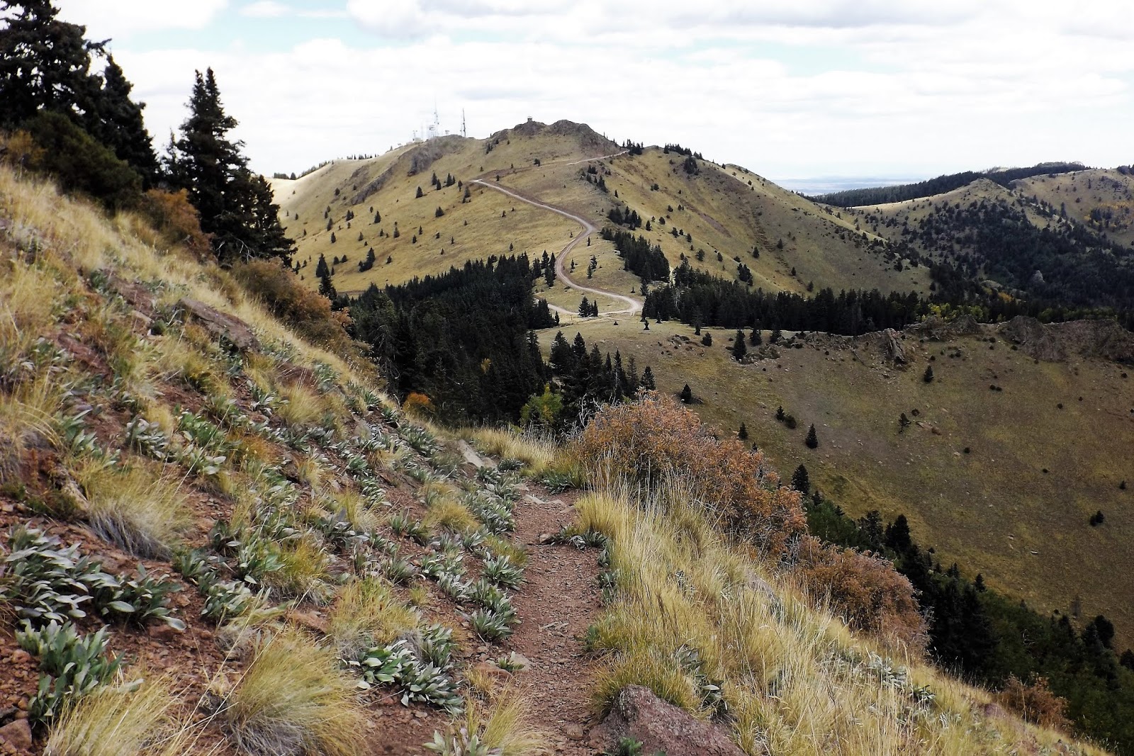
 The same mountain and scary looking cabin, but from our hike along the crest trail.  We're getting closer! 

We had two goals for today's hike.  Ultimately, we hoped to reach Sandia Crest, which is also accessible by car, by hiking uphill through the woods from Sandia Peak, where the tram stops.  We had only been at 5,000' for about 18 hours, so we were hardly used to the altitude.  Suddenly, first thing next morning, we were hiking uphill at over 10,000'.  That, dear reader, is what is known as a shock to the system.  With many stops to catch our breath and stop our hearts from leaping out of our chests, we slowly plodded along like the flatlanders we were.  It was a tortoise and the hare sort of thing, only with no hare.  We did eventually make it to the Crest, where a cafe and gift shop awaited us.

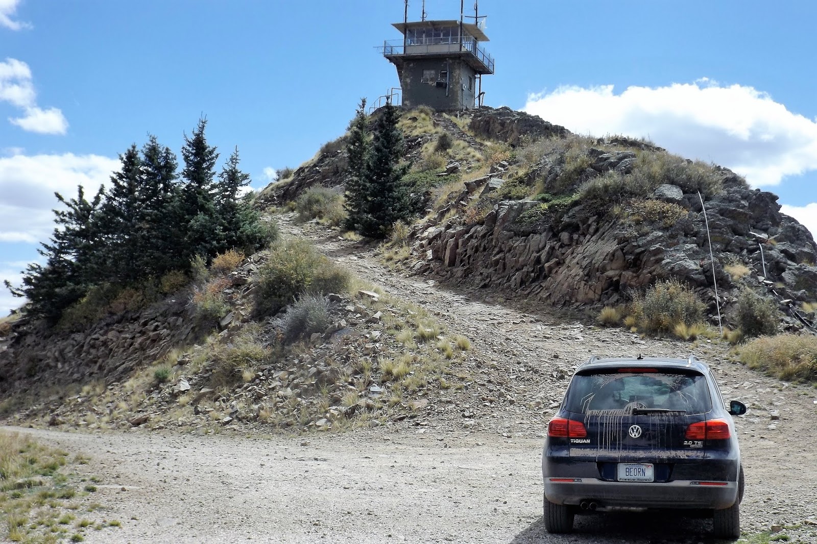
But before the crest came Kiwanis Cabin, which we had seen from the tram flight.  Inside, the cabin was open on four sides, but still cozy inside.  There were stone benches along the inside walls.  Previous manifestations of the cabin had been struck by lightning and burned down, and been blown away by high winds.  This one was solid stone, and hadn't gone anywhere.  Needless to say it is now disused, but makes a good shelter for hikers.

  Arrival at Kiwanis cabin.  We had the place to ourselves!
 
 Looking back from Kiwanis cabin to the top of the tram.  It had been a breathtaking hike (literally!) from there to here.  We were more than halfway to the Crest.

 Our hike began at lower right, and went on diagonally up to the "536" highway at Sandia Crest.  The lower red line shows our tram ride up and across the mountains.  Ski hills at bottom right, and the highway at upper right that leads to the Crest.

Today's hike was about 3.5 miles, and we walked along the crest of the Sandia Mtns. from 10,300' at the tram station to 10,630' at the Crest.  We enjoyed a break at the Crest, with views in all directions, and talked with the husband and wife rangers up there, as well as with the friendly young woman at the gift shop.  Deb had espresso and I had iced tea.  We sat outside on the  deck, over 5,000' above the city below us.

 Deb crosses a portion of Lothlorien on our way to Sandia Crest.

 Sandia Crest, cafe deck.  It was a splendid day!  Albuquerque lies a mile beneath me.

 The dark strip across the lower middle is the Rio Grande River valley.  Albuquerque and the river lies over a mile lower than us.

 Looking over the other side of the mountain.  In the middle ground are the Ortiz Mtns., and behind them are the Rockies, near Santa Fe.

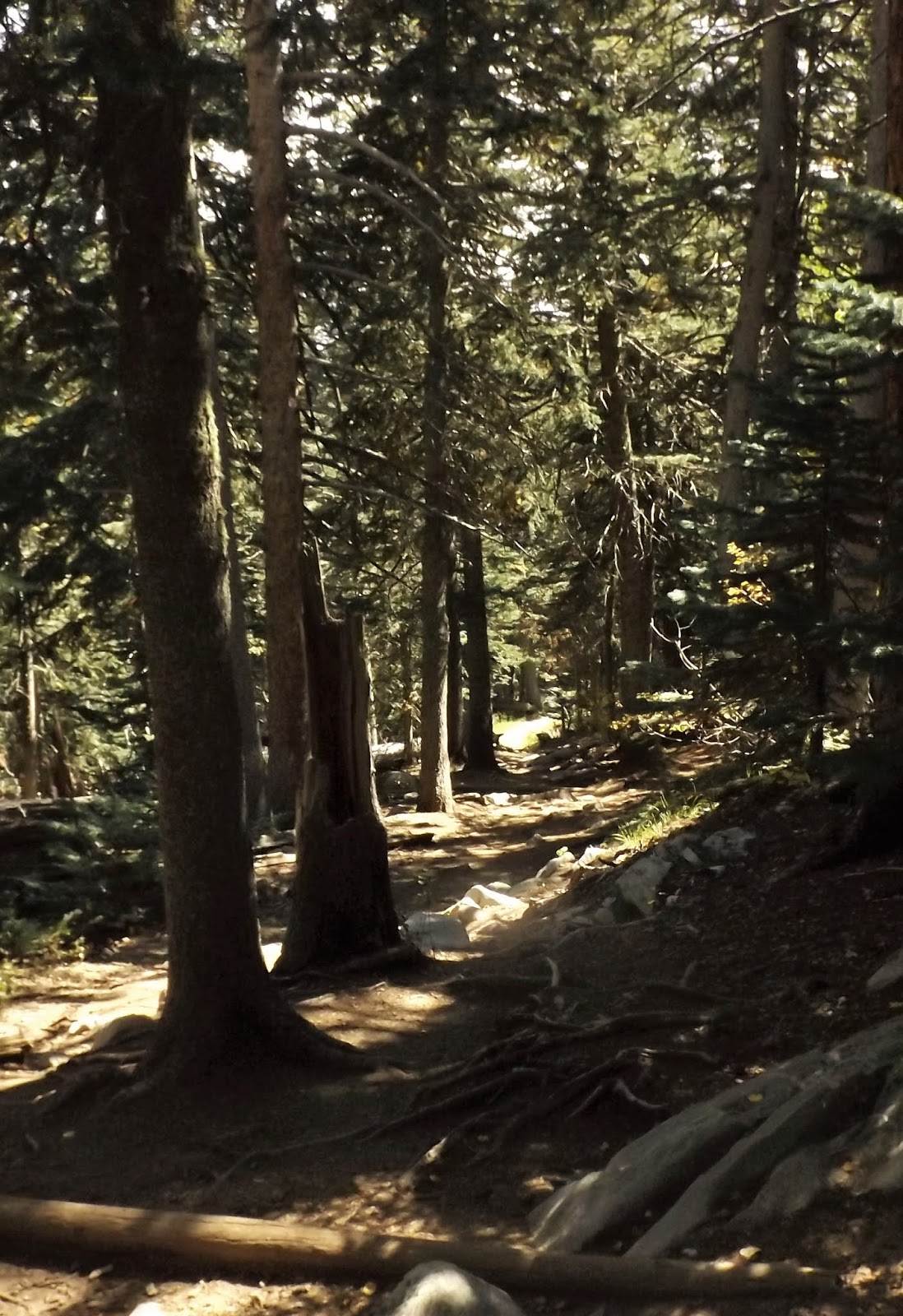
 Our descent trail.  We returned to the tram and rode back down.  
The restaurant usually there was closed for rebuilding, 
and should reopen in the spring. 

 Pulling away from the upper terminal, looking like something from the PC game Riven!  Thunder was beginning to boom as we departed.  Heavy rain and storms were incoming. 

 The afternoon light showed us a different scene than our morning ride up!

 Bye bye Sandias! 

Afterwards, it was time for coffee, at Michael Thomas.  Our pour overs were great!

 Near the cafe was Kellys Brewpub, once a large Texaco station.  This was the only pub for me today, so I lingered and enjoyed my stay.  There were some interesting shops nearby, so Deb vanished for a while. 


 I enjoyed a six-times 4 oz. flight today.  I really enjoyed Kelly's Red Ale, Marble's Double White (a guest ale), and Tractor Brewing's Hard Cider (another guest).  A guy appeared with a Detroit Red Wings shirt, so I went over to his table for a few minutes to talk with him.  He was from Livonia, a Detroit suburb, here visiting a sick relative.  We went to the nearby Co-op and bought a dinner to go.  Again, it was virtually impossible to stay awake past 9 pm, especially with all that fresh mountain air still in our system.  Dreams were sweet....

________________________________________________ 

Thursday was Santa Fe day!  We had not been to this great little mountain city for a proper visit in a very long time.  I ended up driving even less miles today than yesterday, because we rode the Rail Runner up and back. We found a parking lot near the Albuquerque train station (downtown!) for $2 all day.  How does anyone make any money from that??  The Rail Runner is a commuter train that runs from south of Albuquerque to Santa Fe, climbing more than 2,000' to get there.  There are some slow times northbound as the train puffs its way up some serious hills, but the ride home is pretty fast!


The 9:35 awaits at Albuquerque Station.

 There are 8 or 9 stops before Santa Fe is reached, though on the way home we caught an express, with only 3 stops.  When the doors are about to close, one hears the "Beep Beep" of the Warner Brothers road runner, after which the train is named.  The real road runner is the state bird of NM.  We saw one this time, too.

Train window view of the Sandia Mtns.  It had been a very wet night, and the morning was cool and damp.

 The little station in Santa Fe doubles as a tourist info office.

 The main plaza in downtown Santa Fe is now car free!  It is quiet and welcoming.  The plaza is surrounded by shops, museums, and hotels. 

Santa Fe is like a large outdoor shopping outlet mall, with 90% of the shops selling fine art, jewellery, tourist trinkets, and clothing, all with a Southwest flavour.  There is still a daily Indian market on one side of the plaza.  I quickly settled in to Blue Corn Cafe and Brewery, while Deb took a little browse around some of the stores.  We didn't spend a lot of time in the central area, having visited before and not willing to spend thousands of dollars on art today.  We ended up walking back towards the train station, and settling in to 2nd St. Brewery and Cafe, where we had lunch (and I sampled a few ales--6 to be exact).  Next came coffee, at a lovely little cafe right across the street.  We finished up at a hard cider taproom, where I sampled 3 local ciders.  There was a Rhubarb version that did achieve perfection!

Santa Fe has a lot of Santa Fe style architecture.  Surprised?

 Deb checks out the Jean Cocteau Cinema and Coffee House, Santa Fe. 

Once back in Albuquerque, there was time for one more brewpub, which was right across from our hotel!  377 Brewery was a frenzied place after work, and the two guys pouring ales behind the bar were being run off their feet (not by me; I only had two 4 oz pours).  It was a beautiful sunset, and the moon was growing larger.  Tomorrow we were heading into the deep landscape, where three more hikes awaited, and hopefully some solitude.

Thursday evening sunset, walking to 377 Brewery.

 Waxing moon, walking home from 377 brewery.


Mapman Mike